Analysis: Satellite Images Revealed Extent of Key Bridge Collapse
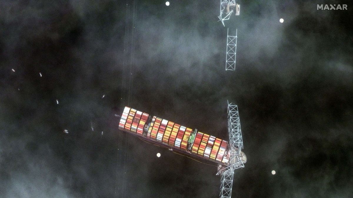
Maxar Technologies recently provided satellite images capturing the aftermath of the Key Bridge collapse in Baltimore, shedding light on the extent of the tragic incident. The 1.6-mile long bridge suffered significant damage after being struck by a cargo ship, leading to a catastrophic collapse, plunging individuals and vehicles into the frigid waters of the Patapsco River. The 984-foot long vessel, the Dali, was en route to Sri Lanka when it lost power, causing it to collide with a vital pillar of the bridge.
Rescue Efforts and Tragic Loss
Following the collapse, eight workers were reported to have been on the bridge, with only two being rescued amid hazardous conditions. Tragically, the remaining six individuals, hailing from various countries including Honduras, Mexico, and Guatemala, are presumed to have lost their lives in the devastating incident. Search and rescue operations were temporarily halted but resumed the following day in a bid to locate the missing workers.
Maxar’s satellite imagery displayed the aftermath of the collision, showcasing the cargo ship lodged beneath sections of the crumbled bridge. The severity of the damage is evident in the photos, underscoring the magnitude of the disaster that befell the Francis Scott Key Bridge.
Investigation and Implications
The cause of the vessel’s power failure leading to the collision remains shrouded in mystery, prompting the National Transportation Safety Board (NTSB) to initiate an investigation. NTSB officials boarded the ship to retrieve crucial data that could provide insights into the sequence of events prior to the tragic crash. The vessel’s data recorder, colloquially known as the black box, will play a pivotal role in piecing together the chain of events.
Moreover, the impact of the bridge collapse reverberates beyond the immediate tragedy, halting vessel traffic in and out of the bustling port of Baltimore. The economic ramifications are profound, with Baltimore’s local economy disrupted as the city grapples with the aftermath of the catastrophic event. Officials have declared a state of emergency in response to the incident, emphasizing the gravity of the situation and the need for swift action.
In conclusion, the satellite images provided by Maxar Technologies not only offer a visual representation of the devastation wrought by the Key Bridge collapse but also highlight the invaluable role of technology in documenting and analyzing such calamitous events. As investigations continue and the community mourns the loss of lives, the aftermath of this tragedy serves as a stark reminder of the fragility of infrastructure and the importance of stringent safety measures in maritime operations.
Image/Photo credit: source url


